Hiking in Sicily: the routes that are worth it
What is the best hike in Sicily?
For most visitors, the Zingaro reserve coast path and the walk up to Cefalù's Rocca give the best reward for the least effort. Serious hikers should add Pizzo Carbonara in the Madonie and a guided crater walk on Etna; Stromboli's summit trek is the most demanding and requires a licensed guide.
Sicily is a hiking island most visitors never notice
The itinerary that dominates a first Sicilian trip — temples, Baroque towns, beaches, a quick look at Etna from a cable car station — leaves almost no room for walking. That is a shame, because the island packs an unusual range of terrain into a small area: an active volcano over 3,300 m, a beech forest old enough to be UNESCO-listed, a limestone coast reserve with no road through it, a canyon full of freshwater pools, and an offshore volcano you climb by torchlight. None of it requires mountaineering experience. Most of it requires a car, decent shoes, and a willingness to start early before the heat sets in.
This guide runs through the routes that genuinely reward the effort, what each one actually demands physically, and where a guide is optional versus legally required. For route-specific detail on the two most-asked-about hikes, see Hiking to the Etna summit craters and The Alcantara Gorges: body rafting and basalt, which covers the water-based alternative to walking.
Mount Etna: the hike everyone means when they say “Etna hike”
Etna is Europe’s tallest and most active volcano, and the walking here happens in two very different registers. Near Rifugio Sapienza on the south side, at around 1,900 m, the Silvestri craters are a flat, easy 20–40 minute loop around dormant 19th-century cones — no ticket, no guide, suitable for anyone who can walk on gravel. It is crowded, touristy, and still worth doing for the scale of the landscape alone.
The real hike starts higher up. Above the cable car’s upper station at roughly 2,500 m, a guided walk continues toward 2,900–3,000 m, on loose volcanic scree, in thin air, with wind that drops the temperature well below what the coast feels like. Above that altitude, a certified Etna guide is a legal requirement, not a suggestion, and even guides cannot take a group into the summit crater zone when the volcano’s activity makes it unsafe. Nobody can promise you a fixed summit date months in advance — full detail on why in Mount Etna: the complete visitor guide and Etna eruptions, ash and safety.
Catania: Mount Etna Trekking Tour Beyond the Tourist Trails goes further than the standard cable-car-and-jeep package, aimed at people who actually want a hike rather than a photo stop. Bring layers even in August — 2,000 m higher than the coast is a different climate entirely.
The Zingaro reserve: the coast walk with no road
The Riserva Naturale dello Zingaro, on the west coast near Scopello and the Zingaro, is Sicily’s oldest nature reserve and the one genuinely car-free stretch of coastline on the island. A single main trail runs along the cliffs between two entrances, with side paths dropping to small coves and beaches that are only reachable on foot. There is an entrance fee, and the reserve can close access on days of extreme fire risk in summer — check before driving out on a July or August weekday.
The walking itself is unremarkable in difficulty: a wide dirt track, moderate elevation change, well within reach of anyone reasonably fit. What makes it hard is the heat — there is very little shade for most of the route, and the coves along the way tempt people to linger past their water supply. Go early, carry more water than feels necessary, and treat the swim stops as the actual reward rather than a detour. Full detail on entrances, distances and which cove to aim for is in the destination’s own coverage; this guide focuses on the fact that it belongs on any hiking shortlist for Sicily.
The Rocca di Cefalù: the best view-to-effort ratio on the island
Above the town of Cefalù, a steep but short path climbs the Rocca, the limestone headland that dominates the skyline, passing megalithic walls and a ruined castle on the way to a viewpoint over the old town, the cathedral and the sea. It takes most walkers 45 minutes to an hour each way, gains real elevation in a short distance, and delivers one of the best panoramas in Sicily for very little time investment.
It is steep enough that flip-flops are a bad idea and there is essentially no shade, so morning or late afternoon beats midday in summer. Cefalù’s historic centre has a ZTL (limited traffic zone) enforced by camera, so park outside it and walk in rather than risk an automatic fine while looking for the trailhead.
Cefalù: Rocca Guided Hike with Photography Tips pairs the climb with a guide who knows where the light works best for photos, useful if you only have one shot at the view.
The Madonie: Sicily’s second mountain range
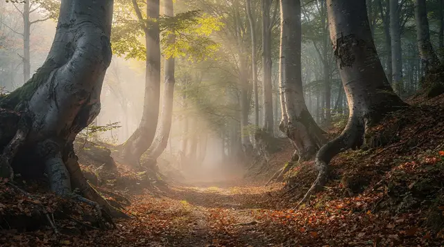
West and inland of Etna, the Madonie hold Sicily’s second-highest peak, Pizzo Carbonara, inside a regional park of beech forest old enough to carry UNESCO recognition as one of Europe’s primary beech woodlands. This is a genuinely different Sicily from the coast — cooler, forested, quiet, with mountain villages like Castelbuono as a base rather than a resort town.
Routes here range from gentle forest walks to the full ascent of Pizzo Carbonara, which is a proper mountain day: several hours, real elevation gain, and worthwhile boots. For the fuller picture of what else the Madonie (and the neighbouring Nebrodi park) offer beyond hiking, see The Madonie and Nebrodi parks.
On the Roof of the Madonie Hike to the Summit of Pizzo Carbonara is the guided summit route to Pizzo Carbonara, useful given how thin the waymarking gets away from the main tracks.
Stromboli: the hike that ends with an active eruption
The most dramatic hike available in Sicily is not on Sicily itself. Stromboli, in the Aeolian Islands, erupts almost continuously in small, spectacular bursts, and a guided evening ascent — the only legal way up — times the climb so the group is near the summit at dusk to watch the Sciara del Fuoco light up. It is several hours of steep, loose volcanic terrain, done as a group with a certified guide, descending in the dark by torchlight.
Two things to know before booking: it requires a reasonable level of fitness and is not suitable for young children, and getting to Stromboli in the first place means a ferry or hydrofoil that can be cancelled by sea conditions with little notice — build a buffer day into any itinerary that depends on it. For the fuller island picture, see Stromboli: climbing and watching the eruptions.
Sunset Trekking to the Craters of Stromboli is the standard guided ascent; there is no independent alternative, by law.
Cava Grande del Cassibile: a canyon hike with a swim at the end
Near Avola and Syracuse, Cava Grande del Cassibile is a steep-sided canyon with a punishing descent — hundreds of steps in places — down to a series of freshwater pools (the laghetti) fed by the Cassibile river. It is one of the most rewarding short hikes in the southeast, and one of the more dangerous ones if treated carelessly: the reserve has closed access in the past after accidents on the descent and after wildfires, so it is worth checking current access before driving out, especially in high summer. Full route detail, safety notes and the best pools to aim for are in Cava Grande del Cassibile.
What to pack, regardless of which hike
A few things apply across every route above: proper shoes rather than sandals, more water than instinct suggests, a hat and sun protection even on paths that look shaded from a distance, and a plan for heat — Sicilian summer routinely pushes inland temperatures past 35°C, with August the single worst month for exertion outdoors. April through June and September through October are consistently better hiking weather, with cooler mornings and evenings and none of the crowding that comes with Ferragosto in mid-August, when much of Sicily itself heads to the coast.
A rental car is close to essential for reaching most of these trailheads — public transport does not serve the Madonie interior or the Zingaro entrances well, and remember that Sicilian town centres almost universally enforce a ZTL with automatic camera fines, so plan parking outside the historic core wherever a route starts or ends in a town like Cefalù.
What to skip
Not every “hike” marketed to tourists earns the name. Short paved walkways dressed up as nature trails, and organised walks that spend more time at wine-tasting stops than on the trail, have their place as a gentler day out but should not be confused with the routes above. If the itinerary lists more meal stops than kilometres walked, it is a food tour with boots, which is a fine thing to book — just book it knowing that is what it is. For a broader look at Etna’s non-hiking options, Quad, buggy and jeep tours on Etna covers the motorised alternative for travellers who want the volcano without the climb.
Guided or independent: where the money is actually worth it
Sicily’s hiking scene splits cleanly into routes you can do alone with a map and routes where a guide changes the outcome, not just the comfort. The Zingaro coast path and the Rocca di Cefalù fall firmly into the first group — waymarking is clear, the terrain is forgiving, and a guide adds little beyond company and local stories. Paying for one there is a lifestyle choice, not a safety requirement.
Etna above the cable car and Stromboli sit at the other end. Here a guide is not upselling: it is the legal and practical mechanism by which access happens at all, because both routes cross terrain where conditions change with volcanic activity and where a local guide’s read of that day’s situation is the difference between reaching altitude and being turned back at a checkpoint. The Madonie’s summit routes land in the middle — technically walkable alone by an experienced hiker with a paper map, but thin enough on signage away from the main tracks that a first-timer benefits from going with someone who already knows where the path actually goes when it stops being obvious on the ground.
A useful rule of thumb: if getting lost mostly costs you time, walk alone and save the money. If getting lost, caught by weather, or caught by a closed section costs you the whole day or worse, pay for the guide.
Building hikes into a wider Sicily itinerary
Few visitors come to Sicily purely to hike, so the practical question is usually how to slot one or two of these routes into a trip built around beaches, ruins and food. Etna and the Zingaro reserve both work well as full-day detours from a coastal base — Etna from Catania or Taormina, the Zingaro from a stay near Trapani or Erice.
The Rocca di Cefalù is closer to an hour of your morning than a dedicated day, easy to bolt onto any Cefalù stop. Stromboli and the Madonie both need more planning: Stromboli because it depends on a ferry crossing that can be delayed by sea conditions, and the Madonie because the villages that make good bases — Castelbuono, Petralia Sottana — sit some distance from the coastal circuit most first-time visitors follow.
For travellers building a full route around the island, both Sicily in 10 days and The full Sicily road-trip loop leave enough slack to add a hiking day without derailing the rest of the plan; a tighter Sicily in 5 days itinerary realistically has room for one, not several.
Frequently asked questions about hiking in Sicily
Do I need a guide to hike in Sicily?
Not for most routes — the Zingaro reserve, the Rocca di Cefalù and the Madonie trails are open to independent walkers on marked paths. Two exceptions: Etna above roughly 2,900 m and any ascent of Stromboli both legally require a certified guide, for safety and access reasons tied to volcanic activity.
What is the hardest hike in Sicily?
Stromboli’s summit trek is the most physically demanding widely available hike — several hours of steep, loose volcanic ground, done at sunset with a guide so the descent happens in the dark. Etna’s summit approach above the cable car’s upper station is a close second, on thin air and scree.
When is the best time of year to hike in Sicily?
April to June and September to October. July and August push inland temperatures past 35°C with little shade on routes like Cava Grande or the lower Madonie trails, and some reserves restrict access on high fire-risk days.
Is the Zingaro reserve hike difficult?
No — the main coastal path is a well-graded dirt track with modest elevation change, suitable for anyone with basic fitness and proper shoes. It is hot and shadeless in summer, which is the real difficulty, not the terrain.
Can you hike Mount Etna without a guide?
You can walk the lower slopes and the Silvestri craters near Rifugio Sapienza freely, with no ticket or guide required. Above about 2,900 m, Italian regulation requires a licensed Etna guide, and access depends on the volcano’s current activity level.
Do you need hiking boots in Sicily?
For Etna, the Madonie and Stromboli, yes — volcanic scree and uneven limestone punish trainers. For the Zingaro path and the Rocca di Cefalù, sturdy trainers with grip are usually enough, though boots are still more comfortable on the descent.
Are Sicilian trails well marked?
Reserve trails (Zingaro, parts of the Madonie) are generally well signposted with numbered paths. Elsewhere — random countryside tracks, some Nebrodi routes — signage thins out fast, which is one more reason a local guide is worth the money on anything beyond the headline routes.
Hiking and outdoor activities on GetYourGuide
Verified deep-linked GetYourGuide tours. Book through these links and we earn a small commission at no cost to you.
Photo: our own image of the location, not the operator’s product photo.